Col de la Couillole - France
The Col de la Couillole is a climb in the Southern French Alps between the Tinee and the Var Valleys, connecting the Saint Sauveur sue Tinee with Cians valley and further with Guillaume in the Var Valley via Beuil and Valberg.
The Col de la Couillole is a quiet mountain pass in the Alpes-Maritimes of southeastern France, rising to about 1,678 meters. The pass sits in a high alpine meadow setting, open and pastoral rather than dramatic or rocky. In summer it’s lush and green, dotted with grazing cattle and wildflowers, while the surrounding slopes are forested with larch and pine. The views are wide and calm, with rolling ridgelines rather than sheer cliffs. The narrow, lightly trafficked road up to the pass makes it popular with cyclists seeking solitude. Starting from Saint Sauveur sur Tinee, the road rises fast and continues for about half of the ride through the steep, gorge like valley of the Vionene river, offering stunning views. A good waymarker is the village of Roubion which is perched high on a clifftop. The pass gained wider recognition after featuring in the Tour de France, highlighting its understated alpine charm. The road is narrow, quiet, and lightly trafficked, giving it a remote feel compared with more famous Alpine cols. It’s well loved by cyclists for its steady gradients and peaceful surroundings. This route marks the boundary between the "Alps" and the Provence with the high peaks of the Park Nationale de Mercantour to the north and the deep gorges of the Provence to the south. The pass sits only about 90km north of Nice.
Col de la Couillole 1678m - Eastern ascend from Saint Sauveur sur Tinee
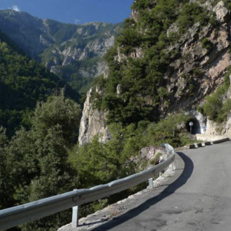
The Col de la Couillole is 16km long and climbs 1,171m in altitude. This is a lovely climb in magical surroundings. This is a HC climb with an average and very steady gradient of 7.3% but which is ticking up temporarily to 15% which makes this climb challenging, especially in the summer months when it can be quite hot. This route is one for the climbing purists, as it is remote and follows a unique road through a fabulous steep and hidden valley with a few ancient looking rickety tunnels thrown in.
As the pass sits in alpine meadows, the way down the other side is an up and down ride with a 2km, 120m ascent to Col de Sainte Anne and a further 3km, 150m ascent to Valberg, interspersed with downhills. The downhill from Valberg to Guillaume goes down crazy switchbacks, past the beautiful village of Peone, and the fabulous Le Tuebi valley, it is 14.5km long, descends 890m and compensated for all the climbing.
Leaving the Tinee valley behind
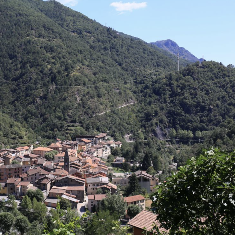
The road is leaving Saint Sauveur sur Tinee and rises 145m over 2.8km to reach the entry to the Vionene valley. This is a short section through four hairpins and bends but leaves the wide open Tinee valley behind in double quick time. Saint Sauveur is a quaint little mountain village and the last stop to pick up some provisions or stop for a coffee before the effort of the climb starts. Given it is quite far south, this climb can be really hot and an early start is recommended.
Into the Vionene valley
The ride through the Vionene valley and high above the river is why you came to ride this road. The road is small, quiet, rickety, windy and interspersed with five small tunnels. The gradient is almost constant just over 7% and the feeling of being immersed in nature grows with every pedal stroke. The road wiggles its way into this fabulously tight valley with the ony hairpins arriving closer to Roubion which is a great way marker and worth a little stop, if only for the views and to fill up bottles. This section is 8.8km long and climbs 700m and is by all measures unforgettable.
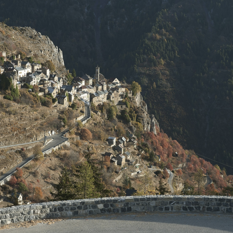
From Roubion to the top at 1678m
After Roubion the nature of the climb starts to change for the last 5km and 370m elevation gain. Gradually, the deep gorge of the Vionene valley is being replaced with a high alpine meadow setting and pastoral greens, there are also more trees providing shadow compared to the previous section which was nearly entirely in the open. The top of the pass features a massive bicycle artwork which makes it unmissable that you have arrived. This pass is truly worth a mountain top finish as it was used in the 2024 Tour De France.
The onward journey is equally as mesmerising as the climb.
Col de la Couillole from Saint Sauveur sur Tinee
Length: 16km
Altitude gain: 1171m
Max altitude: 1678m
Average gradient: 7.3%
Max gradient: 14.8%
Route Tip: The distances around the Col de la Couillole are not insignificant and including this pass in a circular ride will likely push the ride over 130km and over 3500m elevation gain which makes returning the same way a more feasible option. This is still a long ride at just over 90km and 2800m elevation gain. For a multi day ride, the Col de la Couillole can be combined with the Col de la Cayolle and the Cime de la Bonette.