Col du Vars - France
The Col du Vars is a climb in the Southern French Alps, part of the route that connects Briancon in France with Cueno in Italy. This climb is a gentle giant among the French alpine passes. It rides through a wide open valley dominated by meadows, villages and ski resorts. While there are trees, the road does not go through forests and provides great views all round.
With only nine hairpin bends, this pass covers a considerable distance. All of the hairpins are located just above Guillestre, where the road climbs steeply out of the town and into the Vars Valley. From there, it continues more gently through a delightful landscape. The charm of this ride lies in the valley itself and its small, characterful villages.
It is perhaps no surprise that the Col du Vars receives less attention, as it is surrounded by some of the great giants of French cycling. To the north lies the Col d’Izoard, with its dramatic “Casse Déserte” moonscape; further north is the Galibier, with its unrivalled Tour de France pedigree. To the south rises the Cime de la Bonette, which at 2,803 m stands higher than the mountains surrounding the Col du Vars. As a result, many cyclists treat the Vars as a transit pass between these more illustrious climbs. The Tour de France, however, values the Col du Vars highly: since its first inclusion in 1922, it has featured more than 30 times and counting.
Col du Vars – 2,109 m
Northern ascent from Guillestre
The climb from Guillestre is 19 km long, gaining 1,115 m of elevation. While it is by no means easy, it is not among the most demanding Alpine ascents. The first 8 km are the most challenging; thereafter, the road undulates through villages and a ski station before the final push to the summit. Rarely pushing you to the limit, it makes an ideal warm-up climb for a longer ride, such as the Cime de la Bonette to the south. Given the relatively low altitude of the valley and surrounding peaks, temperatures can be high in summer, although—as with all mountain roads—the weather can change quickly.
Into the valley
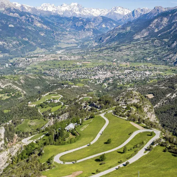
The first 8 km from Guillestre feature a series of long, sweeping switchbacks, with the road climbing to around 1,615 m. This section gains approximately 600 m in elevation and includes the steepest gradients of the climb, briefly reaching up to 14%. As you ascend, there are fine views back over Guillestre, where four valleys converge to form a broad, open landscape below. The road ahead also offers glimpses of the valley to come—lovely scenery throughout. Enjoy these switchbacks, as there are no more further up the valley.
Up and down
The next 4 km to Sainte-Marie are more undulating, with little overall elevation gain and a couple of short downhill sections. The road passes through Saint-Marcellin and gently rolls on to Sainte-Marie, which sits at around 1,650 m.
Here, the valley opens out wide, with mountains of relatively modest height on either side—the Crête de Vars to the left being the highest at around 2,600 m. This lack of dramatic terrain defines the character of the pass: an open valley of meadows, lightly forested hillsides, and lower peaks, all contributing to the gentle charm of the Vars Valley. There are several small villages along the way, offering good opportunities to stop for a coffee.
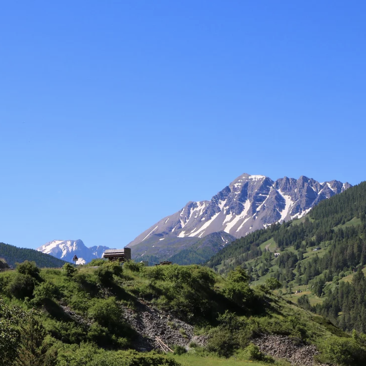
Looking ahead, your gaze is drawn to the jagged Pointe de l’Eyssina massif, rising to 2,837 m.
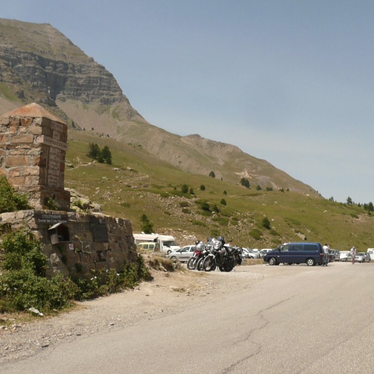
Push to the top at 2109m
After leaving Sainte-Marie, the final section—approximately 7 km—continues to the summit at 2,109 m, gaining around 460 m in elevation, which is very manageable. The valley narrows slightly, and the road leads directly towards the Pointe de l’Eyssina, which becomes a striking focal point ahead.
After passing through the Vars ski station, the mountain rises alongside you, and the road meanders through greenery, trees, and meadows all the way to the summit. It is a particularly pleasant stretch, and the moderate gradients allow you to fully enjoy the surroundings.
The Vars ski station itself is somewhat unattractive and best passed through quickly so as not to detract from the overall beauty of the climb.
Col du Vars from Guillestre
Length: 18.9km
Altitude gain: 1115m
Max altitude: 2109 m
Average gradient: 5.9%
Max gradient: 14.4%
Route Tip: The Col du Vars is a little bit at a dead end destination as circular rides via the Ubaye valley are very long. To extend the ride, you can either do a double ascent north and south or continue to the Col de Larche at the Italian border. The former is around 70km long and 2,000m climbing, the latter (see route) is around 100km long and 2,750m climbing