Col de la Croix de Fer - France
The Col de la Croix de Fer is a climb in the Northern French Alps between Allemond in the Oisans Valley to the south and the Maurienne Valley to the north. The local working man's pass.
For centuries, the pass was first and foremost a route of necessity. Long before cyclists arrived, it linked the valleys of the Oisans and Maurienne, allowing farmers, shepherds, and traders to move animals, cheese, salt, and grain across the mountains during the short alpine summer. It wasn’t a single “road” in the modern sense, but a collection of rough paths used seasonally, when snow retreated just enough to make passage possible.
The name itself—Croix de Fer, “Iron Cross”—comes from the cross erected at the summit, likely in the 19th century. These summit crosses were common in the Alps: markers of faith, protection, and gratitude for safe passage through a place that could be lethal in bad weather. The iron cross became a landmark, a symbolic end point in an otherwise wild and exposed landscape.
The modern road was built in the late 19th and early 20th centuries, encouraged by regional development and later by hydroelectric projects in the surrounding valleys, which brought better access into high terrain.
The Croix de Fer entered cycling history in 1947 with its first appearance in the Tour de France, earning a reputation as a long, wearing Alpine climb often linked with the nearby Col du Glandon. Despite its fame, it remains a seasonal, working pass—closed each winter, dotted with grazing cattle in summer, and shaped as much by weather as by sport.
Today, riding the Croix de Fer means following a route defined not by conquest, but by centuries of quiet, necessary passage through the high Alps.
Col de la Croix de Fer 2,065m - Northern ascend from Villargondran
The northern climb to the Col de la Croix de Fer is around 41 km long and gains 1,980 m in elevation, including the ascent of the Col du Mollard. This is not the standard approach to the Croix de Fer, which starts in Saint-Jean-de-Maurienne, but it is certainly the more interesting one.
The route crosses three passes: the Col du Mollard, the Col de la Confrerie (which is not really a pass in the traditional sense), and finally the Col de la Croix de Fer itself. The southern side of the climb could hardly be more different from the northern side. A number of interconnected valleys branch off the main Arvan valley along the route, allowing villages and farms to be scattered deep into the mountains, far from the Maurienne Valley where the ride begins. As a result, this side feels more charming than remote, with plenty of places to stop and take in the beauty of the surrounding mountains.
This route includes steep sections, descents, and everything in between. Like most major Alpine climbs, it can be divided into three distinct sections.
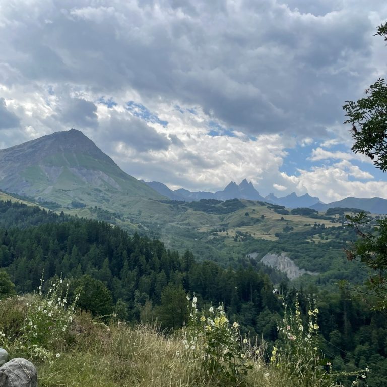
Ascend to the Col du Mollard
Leaving Villargondran, this is a wooded section of road on a narrow and often slightly worn stretch of tarmac—excellent for climbing, though less ideal for descending—where switchback heaven begins. The D80 features 45 switchbacks over an 11 km stretch of road, climbing 740 m at a remarkably consistent gradient of 6.8%. That is one switchback every 220 metres—extraordinary.
After the final hairpin, the road emerges into the open and crosses the Col de la Confrerie at 1,368m altitude. It then continues through beautiful fields and alpine pastures, with excellent views all the way to Albiez and onwards to Les Mollards, where the pass is located.
The pass sits at an elevation of 1,632 m, and this section climbs around 1,000 m over 17.7 km, with an average gradient of approximately 5.8%, meaning the section after the Col de la Confrerie is noticeably gentler than the switchback section below.
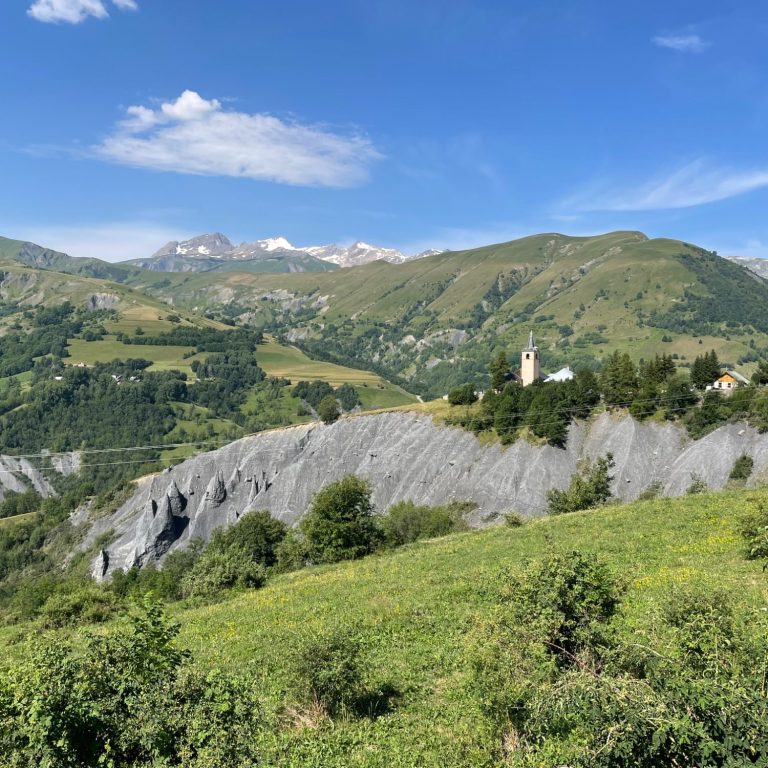
Up and down we go
The next section, from the Col du Mollard to Saint-Sorlin-d'Arves, is an up-and-down affair. It covers 23 km and includes 700 m of climbing, but also around 500 m of descending.
The landscape beyond Albiez is not a typical mountain valley, but more a series of high-altitude pastures from which another three or four valleys branch off, creating a vast, bowl-like mountainous expanse framed by double peaked Aiguilles d'Arves rising to 3,514 m.
Beyond the Col du Mollard, the D80 descends through woods, pastures, and some exposed sections of road before reaching the main road to the Col de la Croix de Fer. After turning towards St Jean de Maurienne and a further short descent, the route turns sharply left uphill onto the D808, the “Scenic Route” towards Saint-Sorlin-d'Arves. Initially, the road climbs steeply before becoming more rolling over the final 5 km. The deeper you ride into the valley, the more expansive the views become, and the road truly lives up to its name: Route Panoramique.
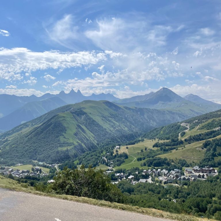
Upper switchbacks to the top
The final section, from Saint-Sorlin-d'Arves to the Col de la Croix de Fer summit, is where this climb truly bites: 6.5 km long with 560 m of elevation gain at a demanding average gradient of 8.6%, frequently reaching double digits and peaking at 16% in places. This is a wall that must be overcome to reach the summit.
The climb opens up views over a landscape that could have inspired Tolkien’s The Hobbit: a mixture of high-altitude pastures, deep valleys, and both rounded and jagged peaks. In the distance the Barre des Ecrins which is the highest mountain in France outside the Mont Blanc range at 4,102m altitude can be seen. By this point, rocks and steep mountainsides have replaced the gentle meadows below, signalling the transition from the greener northern side to the wilder and far more remote southern side of the pass.
After seven gruelling switchbacks, the summit arrives just beyond a narrow rock passage, revealing expansive views over the rugged ridges ahead, dominated by the Aiguille de l’Étendard at 3,464 m.
Route from Saint Jean de Maurienne
The traditional route starts from Saint-Jean-de-Maurienne and involves less climbing than tackling the Col du Mollard first. The route initially leaves town on the D926, which is busy at first, so taking the D110 towards Albiez is a better option.
The road follows the L’Arvan River valley through forests and pastures, with virtually no traffic. After around 5 km, a right turn onto the Chemin du Merderel reconnects the route with the D926. This short 600 m connector is steep and rough, making it suitable for climbing but unpleasant to descend.
The route then continues for another gruelling 7 km along the main road, climbing high above the Arvan valley, which has formed a deep gorge at this point. Just after a series of tunnels, where the gradient eases, the route turns right onto the D808, the “scenic route” to Saint-Sorlin-d’Arves described above.
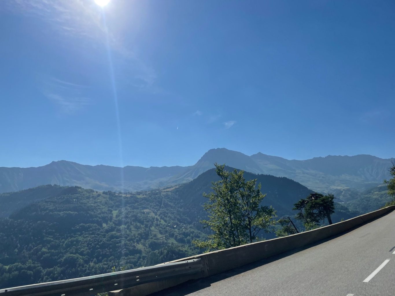
Col de la Croix de Fer 2,065m - Southern ascend from Allemond
The southern climb to the Col de le Croix de Fer is around 29km long and climbs 1,519m in altitude. This is a HC climb with an average gradient of 5.2%, ticking up to 11.9%. The average gradient is misleading though as there are around 4km of downhill in this climb.
Climbing the Col de la Croix de Fer from the south is a long, steady ascent that gradually lifts you from the warmth of Bourg-d’Oisans into the open high Alps. The climb begins gently through shaded villages, then grows more demanding as the road clings to the mountainside above the dams and reservoirs, with widening views and a growing sense of altitude. Higher up, the landscape becomes sparse and exposed, the air cooler and quieter. After cresting the Col du Glandon—only to realize the climb isn’t over—the final rolling traverse leads calmly to the summit, where open meadows, grazing cows, and the iron cross mark a quiet, expansive finish.
From the south, the Croix de Fer doesn’t overwhelm you all at once. It wears you down kindly, patiently—until, suddenly, you’re very high, very small, and very glad you came.
As we come from the south, the descent to the Maurienne Valley can take a number of routes. There is a classic route to St Jeanne de Maurienne or a slightly more up and down and more rickety route via Albiez. Alternatively, La Chambre can be reached via the Col de Glandon.
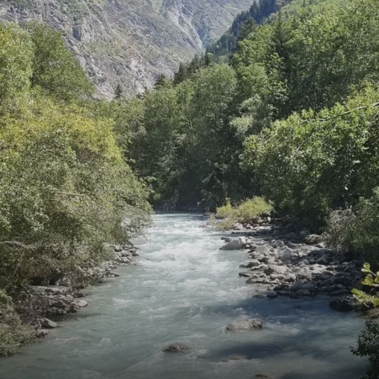
Along the Eau d'Olle river
Leaving Allemond and riding for 10.5km into the valley of the Eau d'Olle with climbing of 560m. For the first 5km we rise above Allemond on the left side of the valley on a side road (not along the reservoir lake - Barrage du Verney) and rejoin the D526 further along. The D526 rises steadily through a heavily forested valley. There are gaps in the trees allowing for views along the long valley. This is a quiet place with no ski resorts or mountain villages. Just a great ride into the mountains. The straightness of the road is broken only by the odd curvature of the side of the valley. It reaches the hamlet of Le Rivier d'Allemont and starts descending quite sharply shortly afterwards for 2km or so.
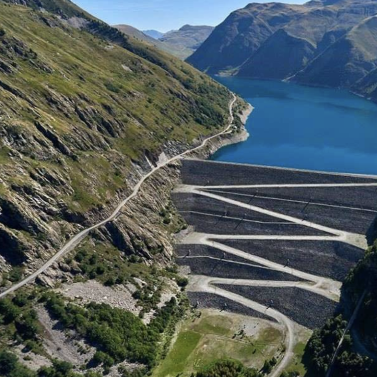
To Lac de Grand Maison
The road drop down through a series of switchbacks and crosses the Eau d'Olle. The next passage is tough. Just over 6.5km in length and around 500m elevation gain to reach the barrier wall of the Lac de Grand Maison. Gradients are frequently over 10% and topping at 15%. The valley become very quiet here with the road is sandwiched between the mountain side and the drop down to the river. After the turnoff of the service road for the hydro dam, the trees virtually stop and you reach the lake totally in the open. As you pull along the massive barrier wall and towards the lake is where the beauty of this place hits you. Barren mountains have replaced the wooded valley as the road rises above the lake and drops down again for another 2km.
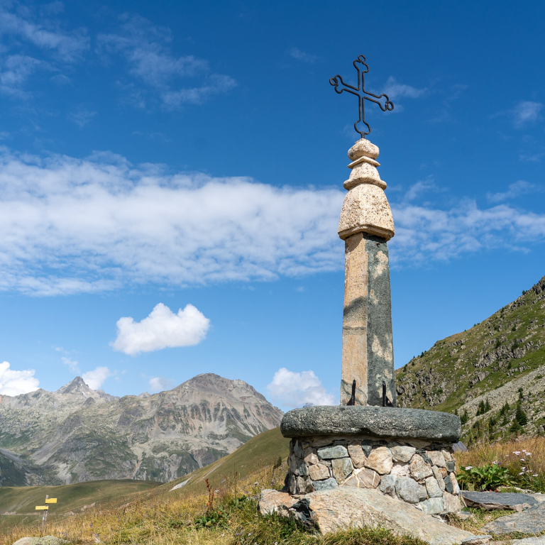
Upper slopes to the top at 2065m
Once on the climb again, there are 5km to go and just over 300m of elevation gain to navigate. The valley has opened up to a huge high alpine expanse. Mountains left and right and the road wiggles its way through this incredible mountain meadow. Ahead, the inn that signals the turnoff to the Col du Glandon comes into view and looking back provides stunning views over the lake. This is such an incredible place. At the turnoff to the Col du Glandon, which is only around 200m up the road, the landscape changes again with the cliffy tops of the surrounding mountains of both passes coming into view. The road is a long sweeping right hander, all the way straight to the top. This is a long but one of the most wonderful roads in the French Alps.
Col de la Croix de Fer from Allemond
Length: 29km
Altitude gain: 1519m
Max altitude: 2065m
Average gradient: 5.2%
Max gradient: 11.9%
Route Tip: A single ascent to the Col de la Croix de Fer is a great ride - see details on Kommot here - but a popular long ride is to descent to St Jeanne de Maurienne from the Col de la Croix de Fer and return via La Chambre and the Col du Glandon. This is a long ride of over 115km and 3,380m elevation gain but covers two of the most epic Tour de France passes in one ride.