Cormet de Roselend - France
The Cormet de Roselend is located in a quiet corner of the French Alps.
The Cormet de Roselend is a high mountain pass in the French Alps, linking the Beaufortain Valley with Bourg-Saint-Maurice in the Tarentaise. At 1,968 m, it has long served as a traditional crossing for shepherds, traders, and local communities moving between the valleys, although it was historically far less important than the great trans-Alpine passes such as the Little St Bernard or the Mont Cenis.
For centuries, the area around the pass was remote and sparsely populated, shaped mainly by alpine farming and seasonal migration. The Beaufortain region became known for its mountain agriculture, particularly the production of Beaufort cheese, and the high pastures around the Cormet de Roselend were used extensively for grazing cattle during the summer months.
The defining moment in the modern history of the pass came in the 1950s and 1960s with the construction of the Barrage de Roselend. This enormous hydroelectric project transformed the landscape entirely. The original hamlets and pastures in the valley were submerged beneath the Lac de Roselend, creating one of the most beautiful artificial lakes in the Alps. The chapel near the lake, rebuilt stone by stone after the flooding of the old village, remains a reminder of the communities that once occupied the valley floor.
The road over the Cormet de Roselend was modernised as part of the dam project, turning what had been a remote mountain crossing into one of the great scenic roads of the French Alps. Despite this development, the pass has retained a quiet and pastoral character, lacking the ski stations and heavy traffic found on many neighbouring Alpine roads.
Today, the Cormet de Roselend is celebrated as one of the most beautiful cycling roads in the Alps and has featured many times in the Tour de France. Riders are drawn not only by the climb itself but also by the extraordinary scenery of the turquoise lake, high alpine meadows, and rugged peaks that define this uniquely tranquil corner of the Alps.
Cormet de Roselend 1,969m - Southern ascend from Bourg Saint Maurice
The Cormet de Roselend from Bourg Saint Maurice is 19.3 km long and gains 1,155 m in elevation. It has a long and respected history in the Tour de France, although it has never achieved quite the same mythical status as giants such as the Galibier or Alpe d’Huez. First included in the race in 1979, it has since appeared regularly and the turquoise Lac de Roselend, the pastoral meadows, and the dramatic mountain backdrop has helped establish the climb as one of the most scenic roads ever featured in the Tour de France. There are distinct sections to this great climb.
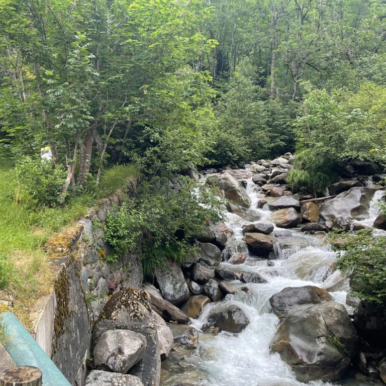
Through the gorge
After leaving Bourg-Saint-Maurice, the first 11.8 km, gaining 680 m in elevation, are probably the toughest section of the climb. Initially, the road crosses open fields as it leaves the Tarentaise Valley before, after a couple of switchbacks, entering a narrow, gorge-like valley.
This is a small road, winding its way through the gorge and the woods, always accompanied by the Le Versoyen stream. After another series of switchbacks, the road finally emerges into the open. On a quiet day with little traffic, this is an exceptionally peaceful place.
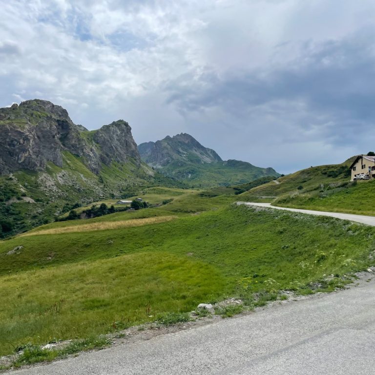
Into the open
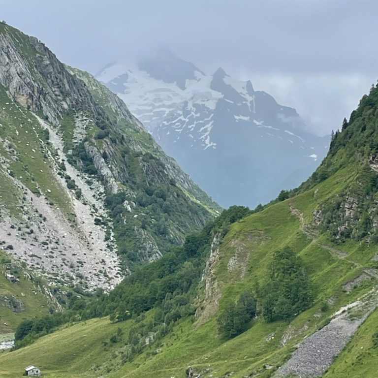
Once out of the woods, the road flattens and enters a widening valley until a left-hand turn reveals fabulous views of the glacier-capped mountains in the distance. The gradient then steepens, and a further series of switchbacks lifts the road out of the valley and onto a high-altitude plateau.
From here, the route twists its way through this meadow-like landscape, with the mountains rising along the left-hand side all the way to the summit. The word Cormet is an older term for a mountain pass, and the unique character of this place makes the name particularly fitting—far more so than simply calling it the Col du Roselend.
The summit itself is marked only by a sign, typical of the passes in Savoy, and a small information board. It feels completely exposed and wonderfully isolated.
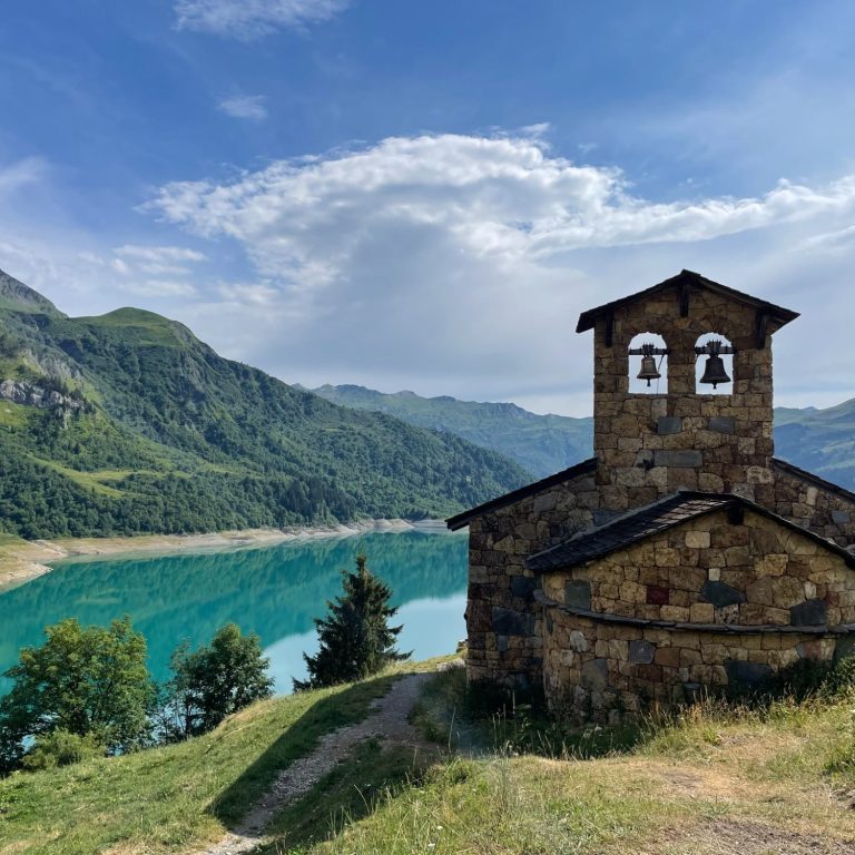
The lake
It is highly recommended to descend to the lake, which lies around 8 km away and 370 m below the pass. As you descend, magnificent views open up over the mountains and the lake—a beautiful combination of forests, water, alpine pastures, and rugged peaks.
The road features fabulous switchbacks and cliffs overlooking the scenery below, making you feel transported into a different world. Past the lakeside chapel, at the junction where the lakeside road meets the D925 main road, an inn invites you to stop for a break and admire the view.
Turning off here and following the lake towards the dam is a wonderful way to spend more time in this magical setting, enjoying the constantly changing perspectives of the lake and surrounding mountains. For those seeking more climbing, the route can be extended to the Col du Pré, which overlooks the lake from an altitude of 1,703 m.
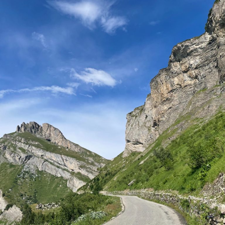
Cormet de Roselend from Bourg Saint Maurice
Length: 19.3km
Altitude gain: 1155m
Max altitude: 1969m
Average gradient: 6%
Max gradient: 9.4%
Route Tip: A ride from Bourg Saint Maurice to the Cormet de Roselend and an extension to the Col du Pre past the lake is 66km long and 1920 m of climbing. Great for a rewarding day in the saddle.