Mont Ventoux - France
Mont Ventoux stands at 1,909m altitude alone as a sole mountain in the hills of the Provence and is one of the key cycling Meccas of the world. The ride is incomparable to any other climb, a symphony of pain and beauty.
Mont Ventoux, the "Giant of Provence," has a rich history that extends far beyond cycling. Rising to 1,909 metres, the mountain has been an important landmark since prehistoric times and takes its name from the Latin Ventosus, meaning "windy"—an apt description for a summit where winds can exceed 300 km/h.
The mountain achieved literary fame in 1336, when the Italian poet Francesco Petrarca climbed it and wrote what is often regarded as one of the earliest accounts of mountain climbing for pleasure and personal reflection. Deforestation led to the white limestone summit which can be seen from miles away and marks the mountain out as true landmark. During the nineteenth century, Mont Ventoux also became a centre for scientific research, with a weather observatory established near the summit.
Today, Mont Ventoux is best known for its place in the Tour de France. First featured in 1951, it became legendary after the death of Tom Simpson during the 1967 race. His memorial, located beside the road near the summit, remains a place of pilgrimage for cyclists from around the world. The mountain has also witnessed unforgettable Tour de France moments, including Eddy Merckx's collapse after his 1970 victory and Chris Froome's famous run to the finish in 2016.
With its relentless gradients, fierce winds, distinctive white limestone summit, and deep connection to cycling history, Mont Ventoux has become one of the world's most iconic and challenging climbs.
There are three routes to the summit of Mont Ventoux. The easiest ascent is from Sault, while the climbs from Malaucène and Bédoin are both significantly more demanding. The classic Tour de France route is the ascent from Bédoin, which is 21.6 km long and gains 1,600 metres of elevation at an average gradient of 7.4%.
That average, however, is slightly misleading. While the climb includes a few gentler sections, the relentless 9.5 km through the forest is among the toughest sustained climbs in cycling, with gradients that rarely offer any respite.
At the time of writing, Mont Ventoux has featured 19 times in the Tour de France and is becoming an increasingly regular fixture in the Tour de France Femmes. The contrast between the stark, windswept mountain and the surrounding lavender fields and vineyards makes this a truly unforgettable ride. These 21.6 km are among the most famous—and most epic—kilometres in cycling.
Like any long climb, the ascent can be divided into several distinct sections, each with its own character and challenges.
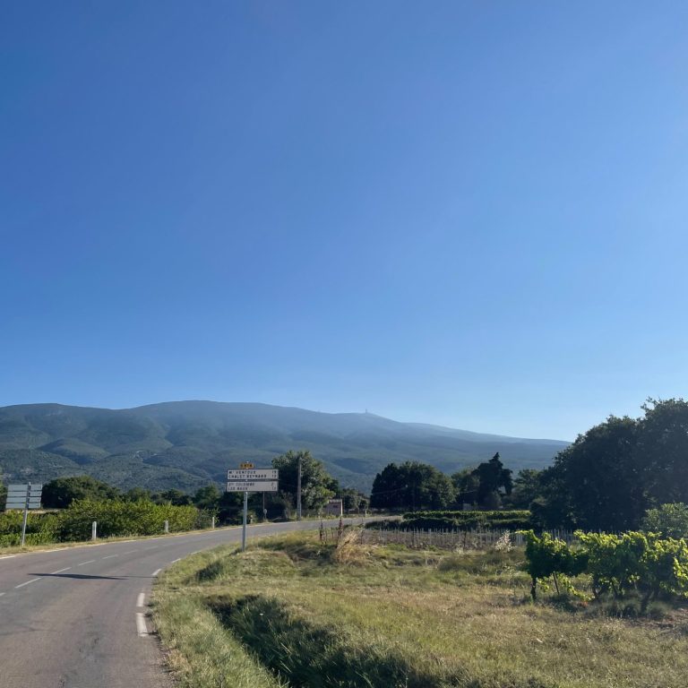
Gentle start
Bédoin is a lovely little village, surrounded by vineyards and very much focused on cyclists attempting to conquer the Giant of Provence.
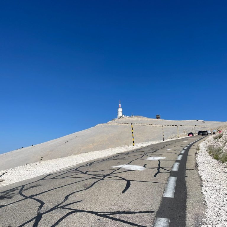
The first 6 km are a gentle introduction to the mountain, with its distinctive white summit overlooking the landscape to the left. Gazing up at the summit, with its telecommunications tower and weather station visible from miles away, the climb appears deceptively manageable. Unfortunately, that's an illusion.
This is a tough climb, and the lack of drama in the surrounding landscape should not lull you into a false sense of security. So enjoy these opening kilometres while you can, because everything changes when you reach the forest.
At Saint-Estève, by Restaurant Le Virage, the gentle introduction comes to an abrupt end. This opening section is 6 km long, climbing 240 metres at an average gradient of around 4%.
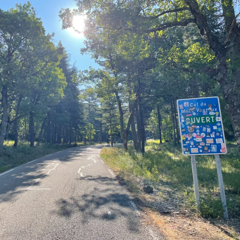
Forest of hell
The next section is 9.5 km long, climbing 875 metres at an average gradient of 9.2%—or, as it is often known, the forest from hell. Given that this is only the average gradient, many stretches pitch well into double digits, with almost no respite from the relentless effort.
This is the hardest part of the climb. Long, straight sections of road rise relentlessly up the mountain, their unyielding gradient making them difficult to match anywhere else. There are only two switchbacks along this section and virtually no views, save for the occasional break in the trees.
This part of the ascent is a true test of both stamina and mental strength, and reaching Chalet Reynard feels as though you have already conquered the mountain. There are no distance markers or indicators to show how far you have climbed, and the only consolation is that the road remains largely shaded, providing welcome relief on a warm day.
The route reaches Chalet Reynard after 15.4 km, having climbed 1,115 metres.
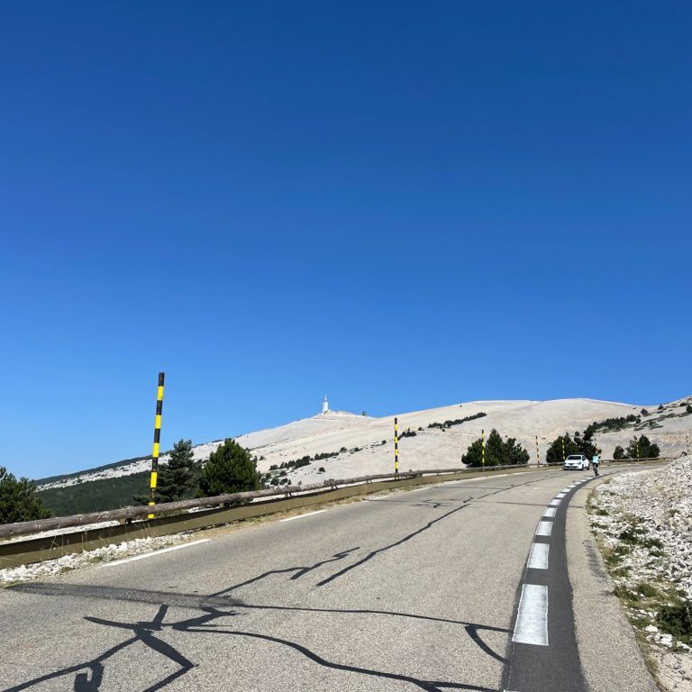
Destinct Mont Ventoux
The final 6 km account for 485 metres of climbing, reducing the average gradient to a more manageable 8% and allowing you to spend at least some of the ride out of first gear.
The last 2 km begin to steepen once again, but by then the summit is finally near, and the pain in your legs—and everywhere else—no longer seems quite so important. This is the section of the climb that makes Mont Ventoux so unforgettable.
Beyond Chalet Reynard, the landscape transforms into a stark, barren world of white limestone, resembling a lunar surface. The mountain is completely exposed to the elements, particularly the wind, which can be ferocious at this altitude. Sheep graze among the rocks and thistles, blending almost seamlessly into the pale hillside. The memorial to Tommy Simpson, who died during the Tour de France on 13 July 1967 comes into view and serves as a poignant reminder of the sacrifices elite athletes make in pursuit of glory.
Everything about Mont Ventoux—its commanding position in Provence, the relentless gradients, the intense heat, the otherworldly lunar landscape, and its rich Tour de France history—makes this an exceptional ride. And who could forget Chris Froome running up the mountain carrying his bike after a mechanical problem, one of the most extraordinary moments in Tour de France history?
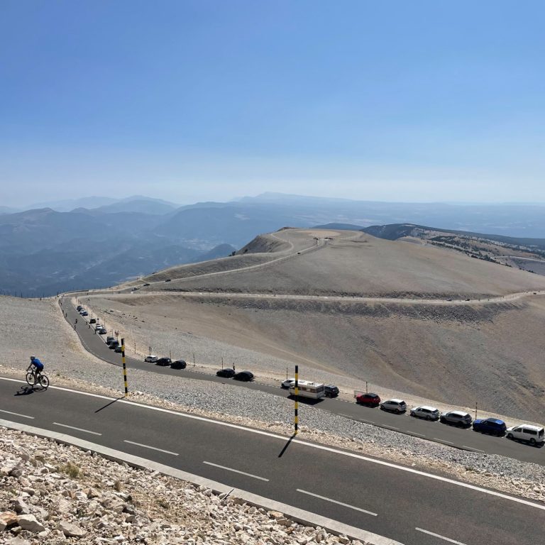
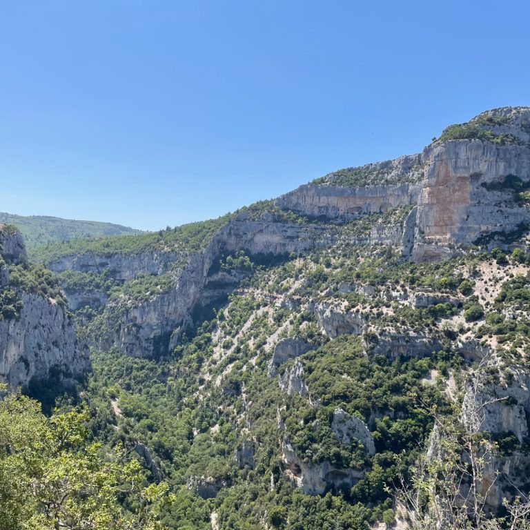
Adjacent to Mont Ventoux lies one of the finest cycling roads you could wish to ride. From Villes-sur-Auzon, the D942 climbs 770 metres over 19 km through the spectacular Gorges de la Nesque. The ascent of Mont Ventoux and the Gorges de la Nesque can easily be combined into one highly rewarding ride (see the route suggestion below).
To climb the Gorges de la Nesque, head to Villes-sur-Auzon, just 11 km from Bédoin. The road rises gently through the gorge at an average gradient of around 4%, weaving along its left-hand side and crossing a series of smaller side valleys. As the climb progresses, the views become increasingly dramatic. As it also loses 350m over the distance, some of the ramps can be steep even if they are short.
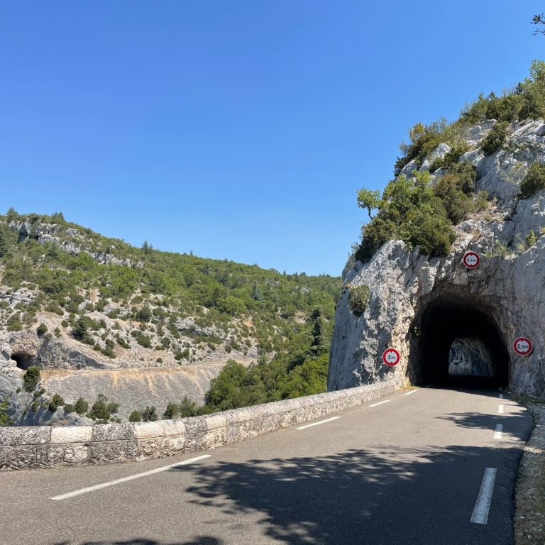
The ascent culminates in a series of narrow rock tunnels before reaching a spectacular viewpoint overlooking the deepest part of the gorge, framed by towering limestone cliffs. It is a beautiful ride, finishing in the charming village of Sault, where the surrounding lavender fields fill the air with their unmistakable fragrance.
Mont Ventoux
From Bedoin
Length: 21.6km
Altitude gain: 1,600m
Max altitude: 1,909m
Average gradient: 7.4%
Max gradient: 15%
Gorges de la Neque
Length: 19km
Altitude gain: 770m (loss of 340m)
Max altitude: 760m
Average gradient: 2.8%
Max gradient: 3.4%
Route tip: The route to Mont Ventoux can be extended by riding back through the Gorges de la Nesque. Starting from Bedoin, this route ascends the classic TdF route to Mont Ventoux and descends instead to Sault which is a lovely and measured road. From Sault, the D942 first gentrly climbs through lavender fields and then the gorge itself before reaching the lookout point at the hight of the gorge. A long and wonderful road down to Villes sur Auzon awaits which will put a smile on your face. The total route is 87km long and climbs 2,080m. Lovely stuff.